Freebird Forever Loop
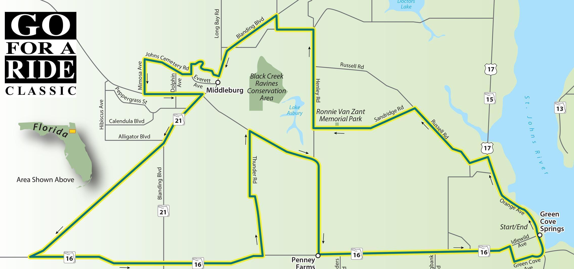
Freebird Forever Loop
Scenic Ride 30
This ride bridges the gap between southern rock music and department stores. Starting and ending in Green Cove Springs, a small town south of Jacksonsville. Along the first half of this ride you'll pass the Ronnie Van Zant Memorial Park, a tribute to the Lynyrd Skynyrd founder. The last part of the ride takes you through Penney Farms, a town that was founded as an experimental farm by J.C. Penney, of the department store fame. Today it's a retirement community.
Road Name - Direction - Miles
- Start in Green Cove Springs at US 17 and Leonard C Taylor Pkwy
- US 17/N Orange Ave - North - 4.0 Miles
- CR 209/Russell Rd - Left - 0.6 Miles
- CR 209/Russell Rd - Right - 2.7 Miles
- CR 739B/Sandridge Rd - Left - 3.7 Miles
- (Ronnie Van Zant park will be on your right along this road)
- CR 739/Henley Rd - Right - 3.5 Miles
- CR 220W -Left -1.3 Miles
- Baxley Rd -Right - 0.5 Miles
- SR 21/Blanding Blvd - Left - 3.1 Miles
- Scenic Dr - Right - 1.7 Miles
- Johns Cemetery Rd - Right - 1.7 Miles
- N Mimosa Ave - Left - 1.2 Miles
- CR 218 - Left - 2.1 Miles
- SR 21/Blanding Blvd - Right - 2.1 Miles
- CR 215 -Right - 6.1 Miles
- SR 16 - Left - 8.2 Miles
- Thunder Rd - Left - 4.5 Miles
- CR 218 - Right - 5.8 Miles
- SR 16 - Left - 6.7 Miles
- S Oakridge Ave - Right - 0.6 Miles
- Green Cove Ave - Left - 0.6 Miles
- Cooks Ln - Straight - 0.5 Miles
- Returns to starting point