Auburndale Loop Scenic Ride
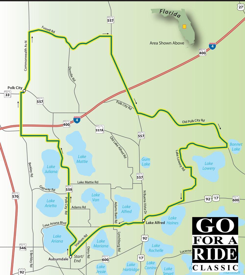
Auburndale Loop
Scenic Ride 19
Auburndale was founded in 1880 by some northern folks seeking a warm winter refuge. Since then, the citrus groves and ranching have been the maintstays of the local economy. The rural setting is what makes this ride appealing as you roll past the multitude of lakes in this area. We doubt you'll find a road with more curves per mile than Lake Lowery Road.
Road Name - Direction - Miles
- Start in Auburndale at N Bartow Ave & Stadium Rd
- N Bartow Ave/SR 559 North 0.1
- Lake Stella Dr - Right - 0.2 Miles
- N Main St - Right - 0.1 Miles
- Lake Ariana Blvd - Straight - 1.4 Miles
- Polk City Rd/SR 559 - Right - 4.4 Miles
- Will Van Fleet Rd/CR 559A - Left - 0.7 Miles
- C Fred Jones Blvd - Left - 1.2 Miles
- Berkley Rd/CR 655 - Right - 2.1 Miles
- Commonwealth Ave/SR33 - Left - 3.0 Miles
- Fussell Rd - Right - 4.4 Miles
- Old Grade Rd/CR 557 - Right - 4.0 Miles
- Haines City/Old Polk Rd - Left - 5.5 Miles
- Lake Lowery Rd - Right - 5.8 Miles
- Old Haines City/Lake Alfred - Right - 0.8 Miles
- Experiment Station Rd Left - 0.1 - Miles
- E Alfred St/US17 - Right - 1.4 Miles
- W Pierce St - Right - 0.8 Miles
- Lake Alfred Rd - Straight - 2.3 Miles
- Stadium Rd - Straight - 1.0 Miles
- Returns you to starting point