Fernandina Amelia Island
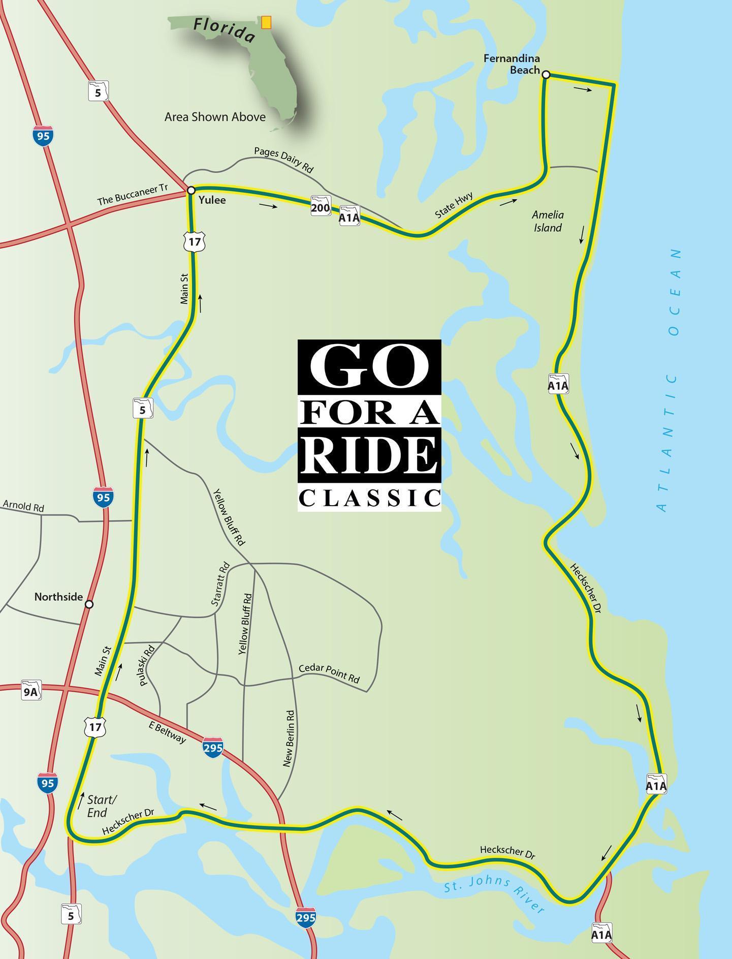
Fernandina Amelia Island
Scenic Ride 39
There are few places in Florida that can match the historical legacy of the northeastern corner of the state. Eight different flags, including those of Mexico, Spain, France, and England have laid claim to Amelia Island and the surrounding territory in a timeline that stretches back more than 400 years. This month's ride runs through the coastal marshlands, down the coastline, and along the St. Johns River. Along the way, you can turn back the pages of time in historic Fernandina Beach or hit the beach on Little Talbot Island, one of the few undeveloped barrier islands left on the Florida coastline.
Road Name - Direction - Miles
- Start in North Jacksonville at Main St (US 17) and Hecksher Drive
- US 17/Main St - North - 15.9 Miles
- A1A/Buccaneer Trail - Right (East) - 11.3 Miles
- Atlantic Ave - Right - 1.6 Miles
- A1A/S Fletcher Ave - Right - 4.9 Miles
- Amelia Island Pkwy - Left - 1.7 Miles
- Julia St - Straight - 0.1 Miles
- A1A/1" Coast Hwy - Left - 14.7 Miles
- Heckscher Dr - Straight - 14.3 Miles
- US 17/Main St - Right - 0.3 Miles
- Returns you to the starting point